Course Home | Setting | Nile Hydrology | Predynastic Development | Dynastic Egypt |
Course Home | Setting | Nile Hydrology | Predynastic Development | Dynastic Egypt | |
Managing the Waters of the Nile |
||
| This page added 10-30-2012 | LAST UPDATE: 10-30-2012 | |
|
|
||
|
|
||
|
|
||
|
|
||
|
|
||
|
|
||
|
|
||
|
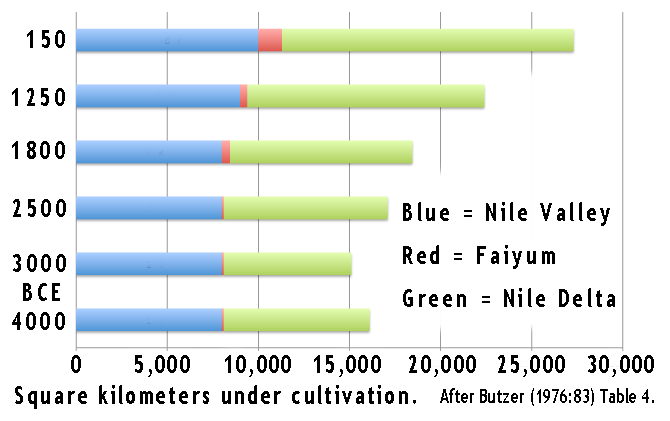
The growth of cultivation in the Nile Valley from 4000 to 150 BCE, measured in square kilometers. Notice that the entire lower Nile system system was under cultivation well before the unification of Egypt, around 3200 BCE. |
||
|
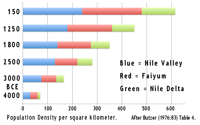
Population Density per square kilometer. Increased density reflects greater crop diversity, land reclamation, a greater variety of domestic animals, advances in hydraulic technology, and better organization of production and redistribution of food and other products. |
||
|
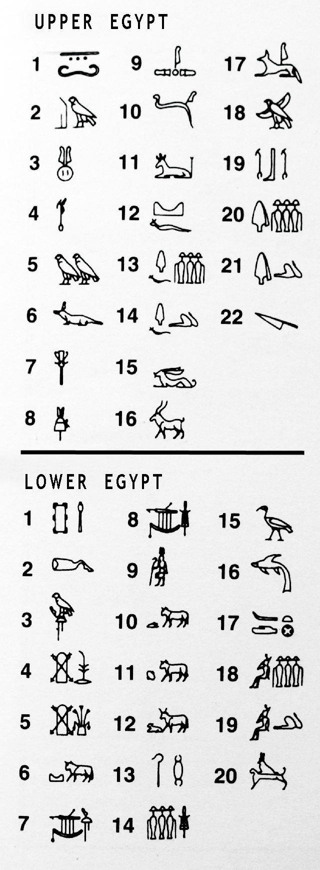
Ensigns by which we know the nomes of Egypt. Nomes in Lower Egypt were very fluid and did not stabilize into this list of 20 until the Roman period. Nomes in Upper Egypt became fixed by the 5th Dynasty and remained relatively stable thereafter. |
||
|
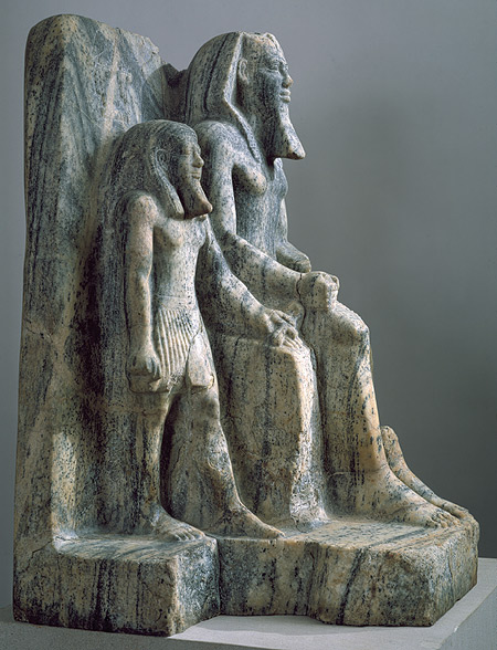
This is the only preserved three-dimensional representation that has been identified as Sahure, the second ruler of Dynasty 5. Seated on a throne, the king is accompanied by a smaller male figure personifying the local god of the Coptite nome, the fifth nome (province) of Upper Egypt. This deity offers the king an ankh (hieroglyph meaning "life") with his left hand. The nome standard, with its double-falcon emblem, is carved above the god's head. Sahure wears the nemes headcloth and straight false beard of a living pharaoh. The flaring hood of the uraeus, the cobra goddess who protected Egyptian kings, is visible on his brow. The nome god wears the archaic wig and curling beard of a deity. |
||
|
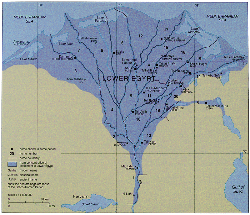
The nomes of Lower Egypt. |
||
|
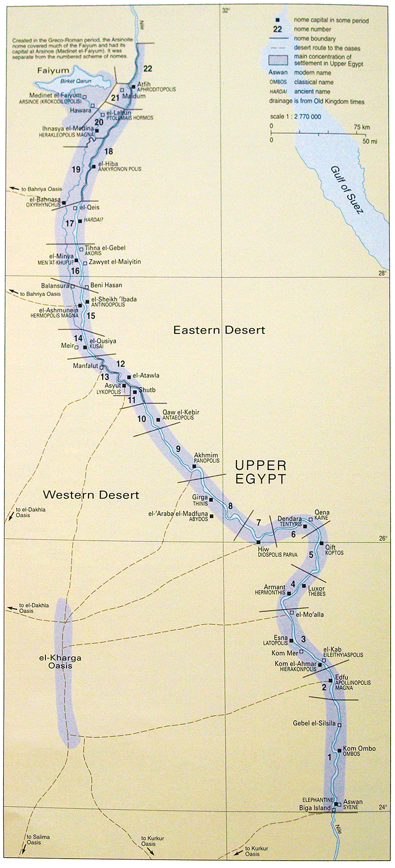
The nomes of Upper Egypt. |
||
|
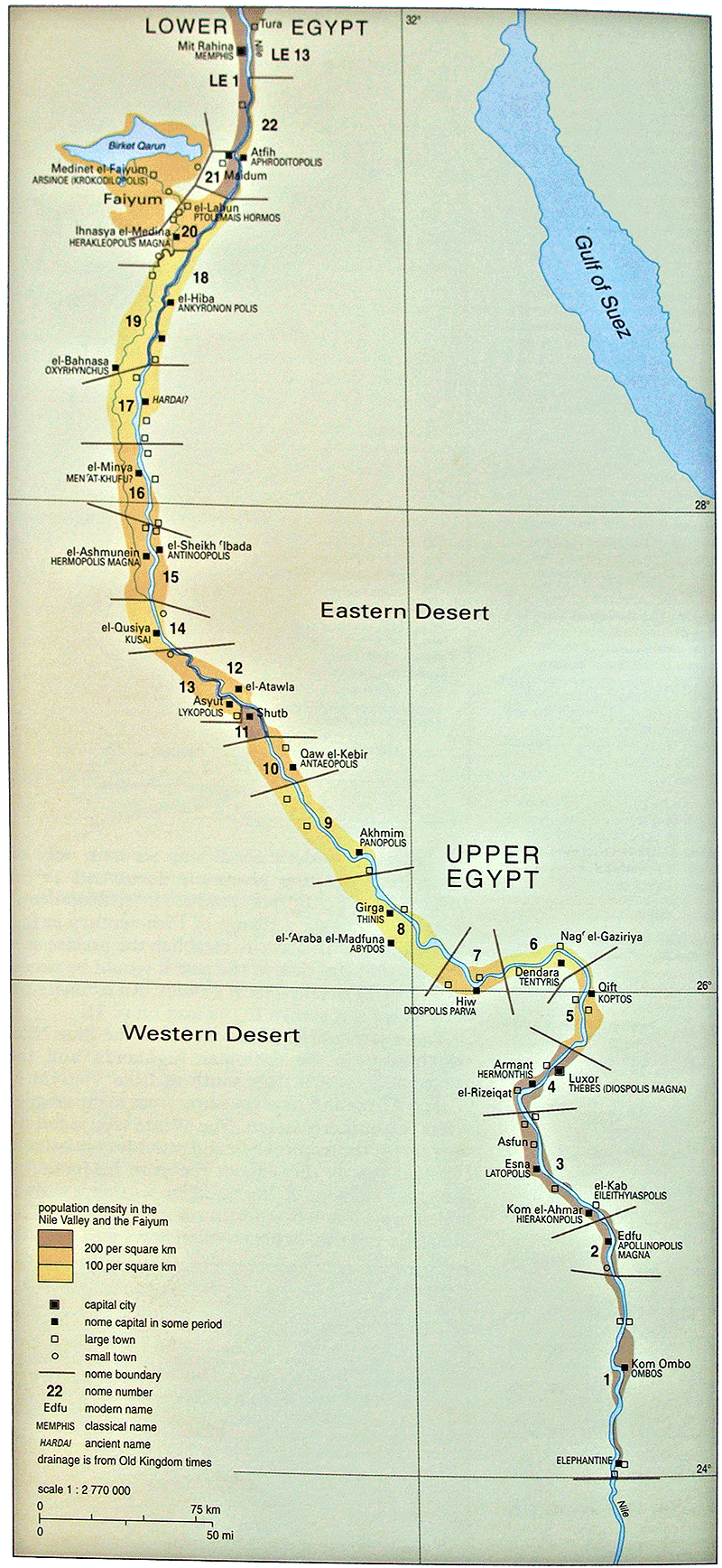
Population density mapped by Nome. Upper Egypt during the Old Kingdom. |
||
|
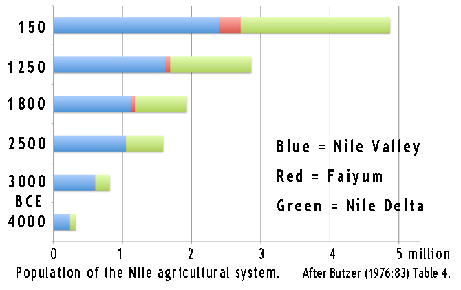
Total population of the ancient Nile agricultural area. |
||
|
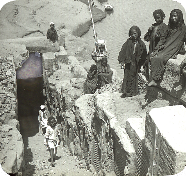
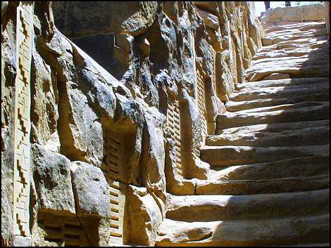
Nilometer at Aswan. |
||
|
Looking up out of the kilometer at Aswan. |
||
|
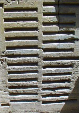
Reading slits in the kilometer at Aswan. |
||
|
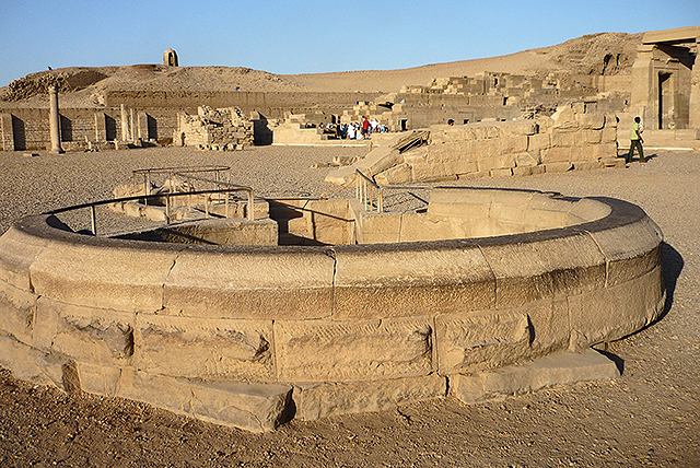
Nilometer in the temple at Kom Ombo. |
||
|
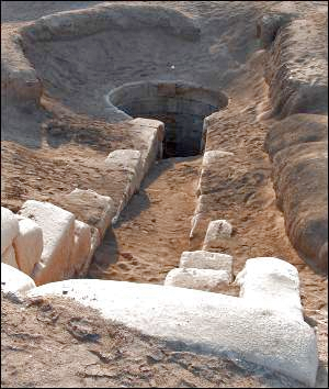
View into the Nilometer at Kom Ombo. |
||
|
One of the Nilometers at Tanis (San el-Hagar), on the eastern margin of the Nile Delta. |
||
|
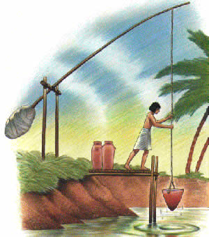
Drawing of a shaduf in action. |
||
|
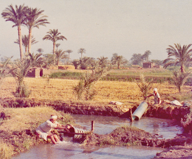
Real shaduf in action. |
||
|
Water wheel in the Nile Delta. |
||
|
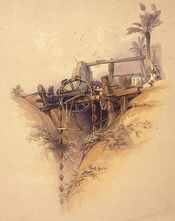
Well wheel. |
||
|
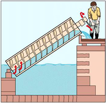
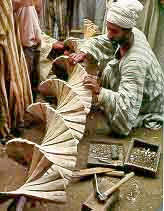
Archimedes Screw drawing and one under construction using traditional materials in Egypt. |
||
|
Archimedes Screws being used to lift water in Egypt. |
||
|
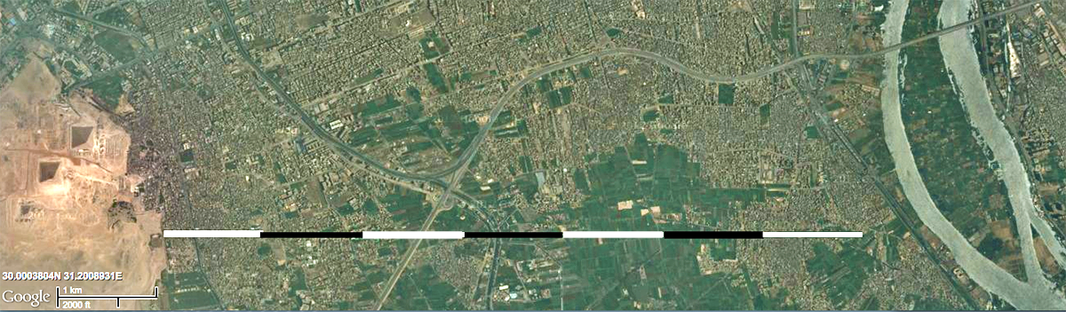
Primary and secondary distribution canals. |
||
|
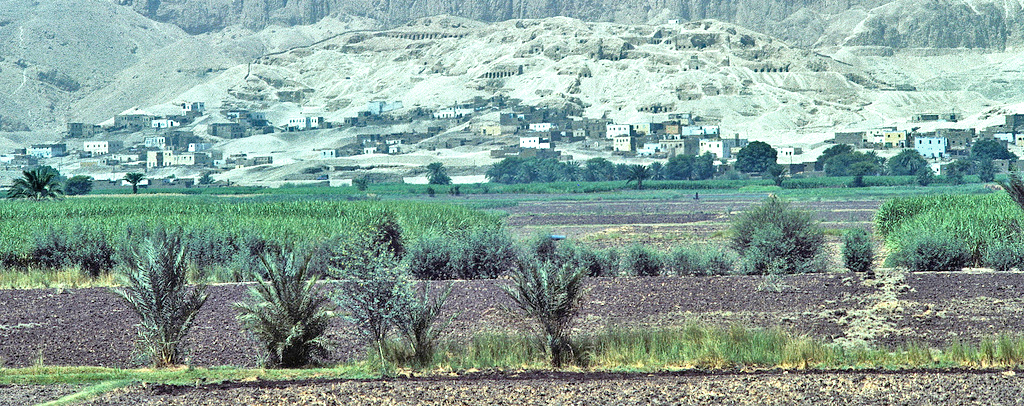
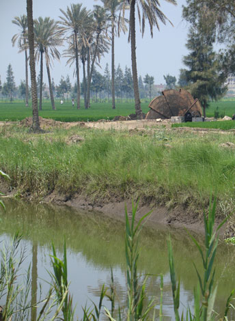
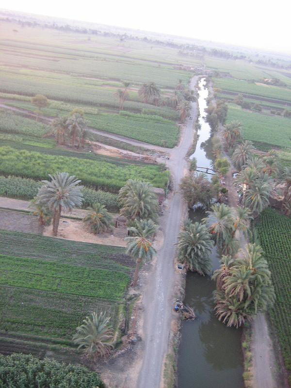
Nile Delta distributary channel (tree line) and main canal (foreground). |
||
|
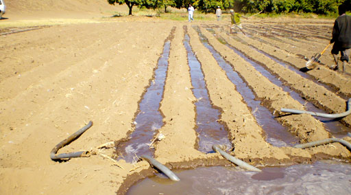
Siphon irregation. |
||
|
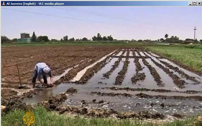
Knockout field irrigation. |
||
|
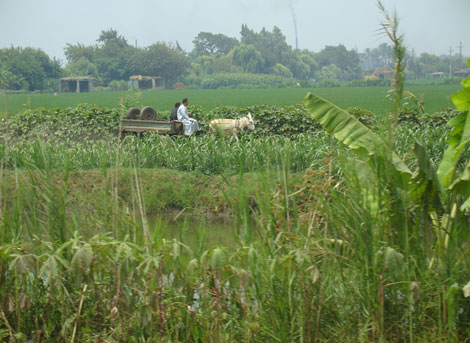
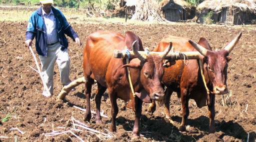
Cattle used to plow fields. |
||
|
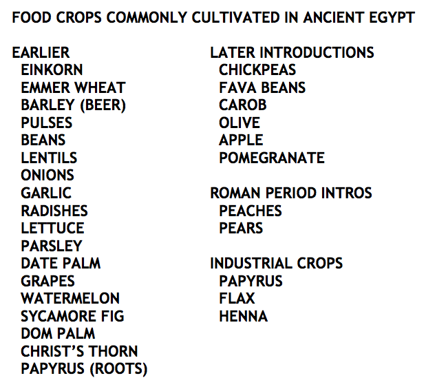
Crops of ancient Egypt. |
||
|
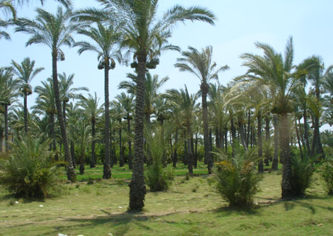
Date palms. |
||
|
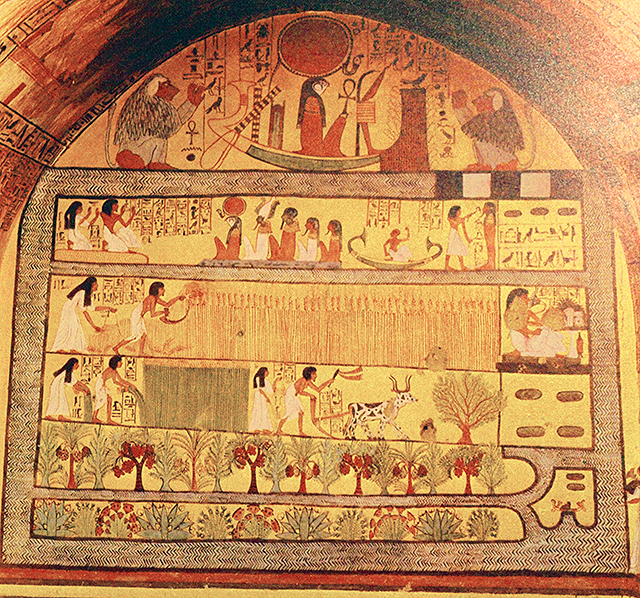
Harvesting in the afterlife. |
||
|
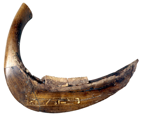
Wood and flint sickle, 1300 BCE. |
||
|
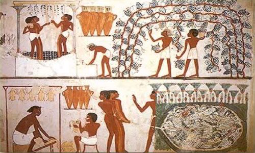
Harvesting grapes and producing wine from them. |
||
|
©2012 by Charles M. Nelson All rights reserved. |